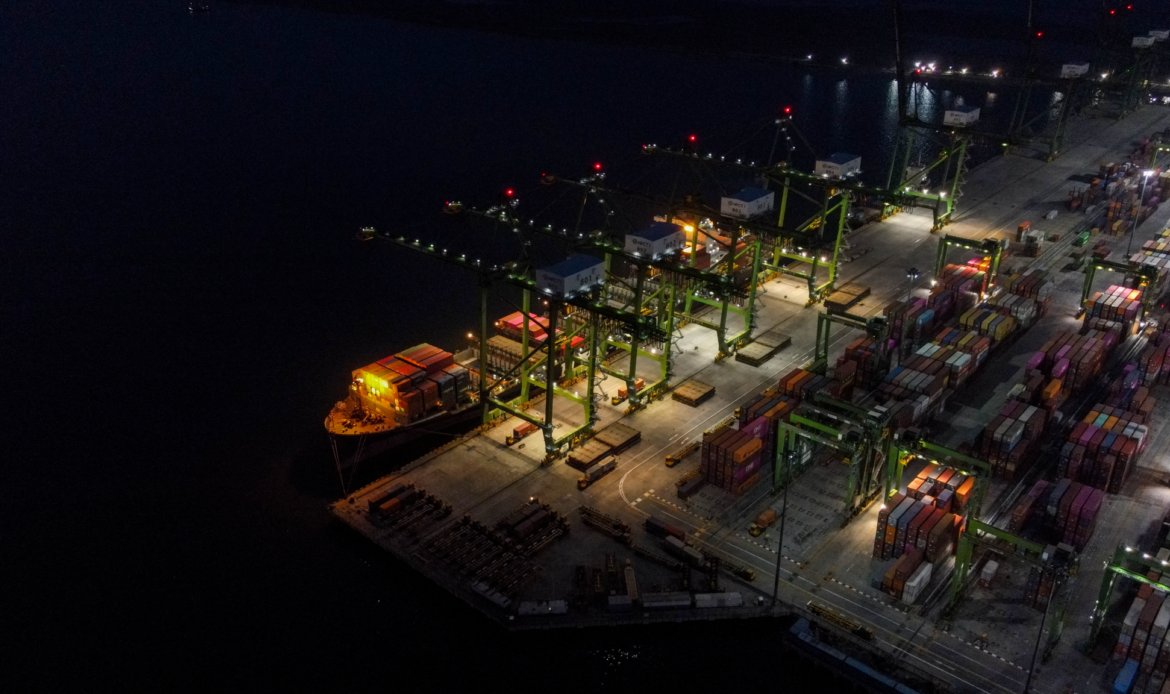
SensorTec seaports and coastal solutions are intelligent surveillance AI-based systems that provide various surveillance sensors, this way they ensure the most comprehensive coverage for marine applications. Leveraging high resolution visible light and thermal sensors, marine radars and advanced AI computer vision technologies. Our solutions seamlessly integrate with a variety of VTMS systems, offering automatic tracking functions powered by AIS and GPS telemetry.

SensorTec offers a wide range of solutions, tailored for short, medium and long range day/night and thermal infrared imaging in seaports and marine applications. Our solutions play a vital role in Vessel Tracking Monitoring Systems (VTMS) by recognizing, identifying and tracking targets using AIS and radar data. Our systems are designed for offshore applications and can also be installed on different types of vessels or boats.
VISUAL ENHANCEMENT USING
HIGH-END SENSORS

SensorTec seaports and coastal solutions are designed to fully cover immense areas even on challenging terrains using high-end surveillance sensors.
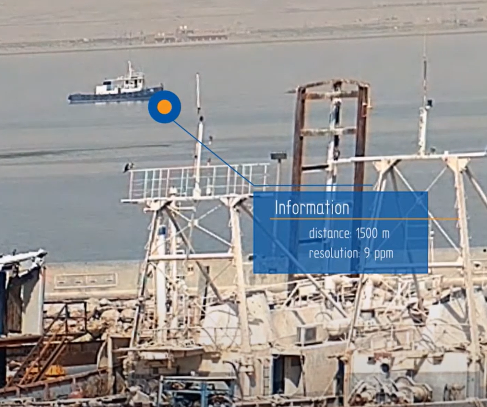
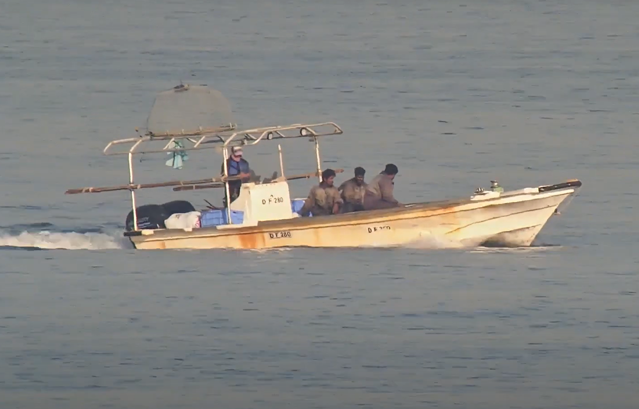
The main line of visual coverage consists of our dual-vision panoramic cameras along with multi-sensor PTZ cameras. A single panoramic camera provides up to 320MP resolution for visible light surveillance and up to 6MP for thermal vision. Its resolution allows to detect small boats within a range of up to 6km.
Three of 320MP panoramic cameras can be installed at a single spot, providing 960MP resolution for visible light surveillance and 18MP for thermal vision. It provides 120° FOV and effectively monitors an area of 9.6km² from a single viewpoint.

AI-POWERED
VIDEO CONTENT ANALYSIS


Covering vast areas with extremely high resolution is just the initial stage in effective surveillance. SensorTec seaports and coastal solutions are developed to automatically detect, track, classify and counter/neutralize various object types within the monitored area.
Our algorithms precisely recognize objects, alerting operators when potential threats are present in the field. Our AI-powered VCA accurately classifies animals, humans, heavy or light vehicles, vessels and boats.
The Real-Time Decision Making Support optimizes the front-end visualization of all detected objects, highlighting relevant or urgent situations in the user interface. This process ensures that operators receive filtered information, allowing them to make informed decisions based on visual verification to determine whether the moving objects are friendly, neutral, or pose a potential threat.
AUTOMATIC OBJECT DETECTION

SensorTec developed a specific sensor fusion technology, which realizes exceptionally accurate object detection in the surveillance area. The Video content analysis and the radar data analysis are combined together. The algorithm recognizes any suspicious moving object in the distance that could be a potential threat.
Geofencing function allows specific detection configurations within the covered area. Zones can be virtually designated which for various detection rules can be assigned.
AUTOMATIC OBJECT TRACKING

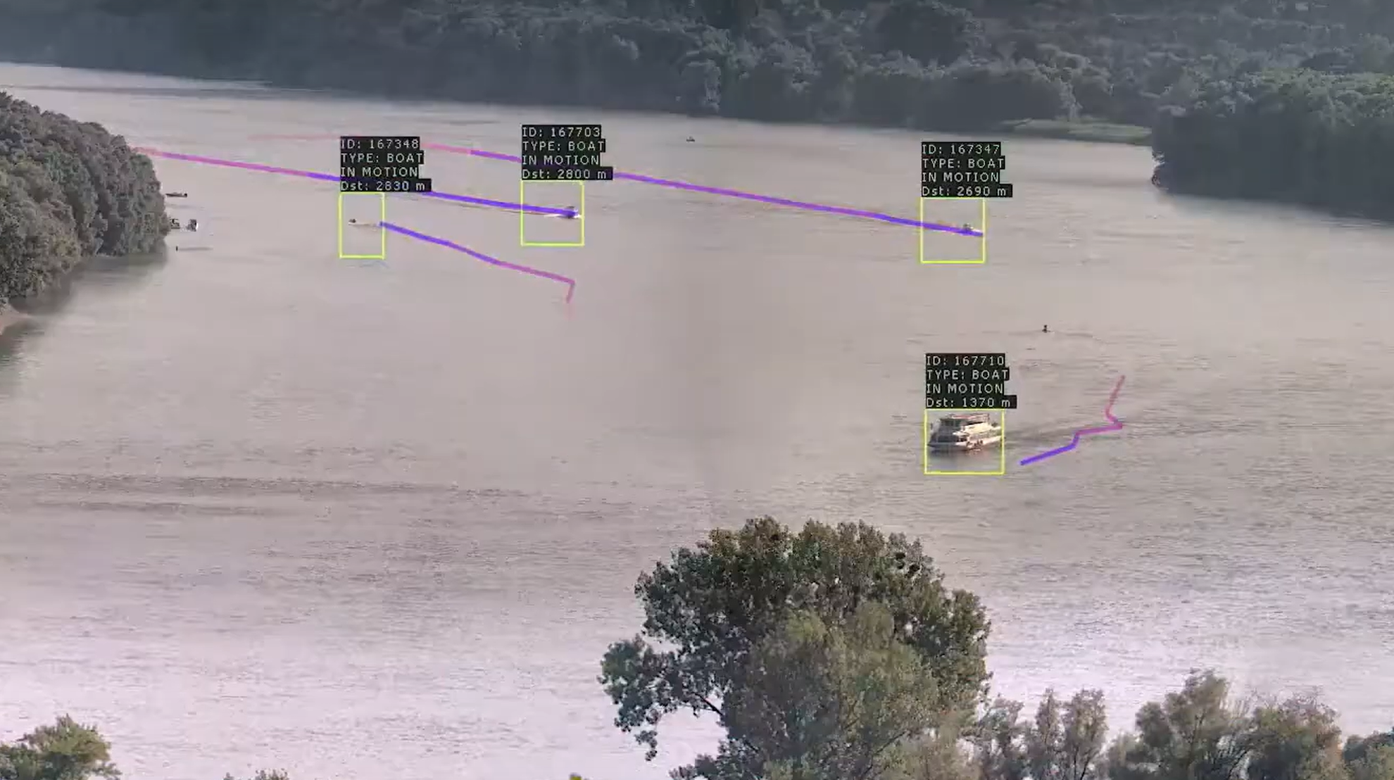
Our system automatically tracks the motion of all detected objects. Even if they move between camera images, the AI-powered VCA accurately follow and record their paths in the images. The algorithm is able to track 2500 targets at the same time and operators are able to lock the selected ones for automatic tracking in individual zoom windows.
Based on GPS coordinates that are delivered by the radars and also calculated by interpolation on the panoramic images, the system automatically controls PTZ and thermal PTZ cameras.
TARGET LOCALIZATION
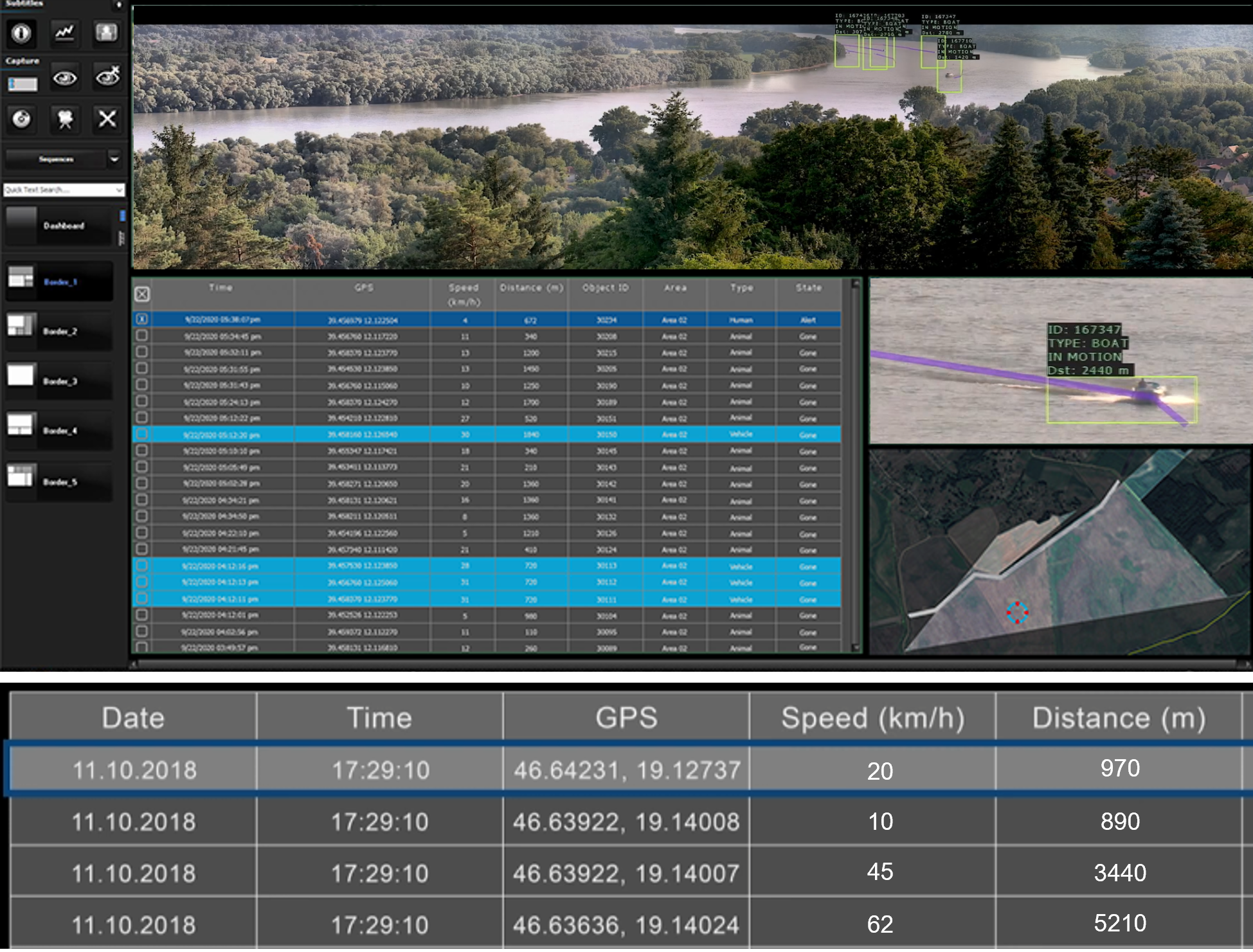
In order to respond threats effectively, the exact positions of targets must be known beside tracking them. Our system delivers the precise GPS coordinates, speed and heading information of all detected objects from the moment of detection. The system uses both radar information and VCA calculated coordinates for localization.
OBJECT CLASSIFICATION

SensorTec AI-powered classification function precisely recognizes animals, humans, heavy and light vehicles, vessels, and boats even at great distances. This process ensures that operators receive filtered information, allowing them to make informed decisions based on visual verification to determine whether the objects are friendly, neutral, or pose a potential threat.
GEOFENCING AND VIRTUAL FENCE
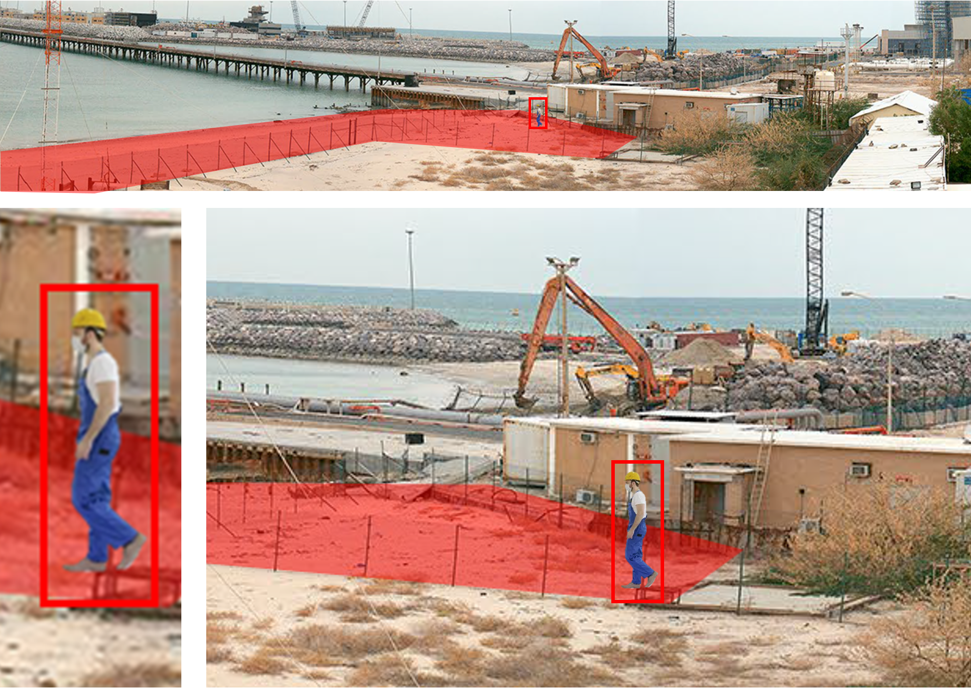
Our system geofencing function allows to virtually map existing zones on camera images. These configured zones facilitate orientation and accelerate object search. They can easily find objects during live monitoring or archive search, Operators can designate temporary zones and they can define various rules to these areas. They can simply draw around a static object or a desired area and apply relevant rules. The activated rules take effect on this area and trigger different warnings or alerts.
THIRD-PARTY INTEGRATION
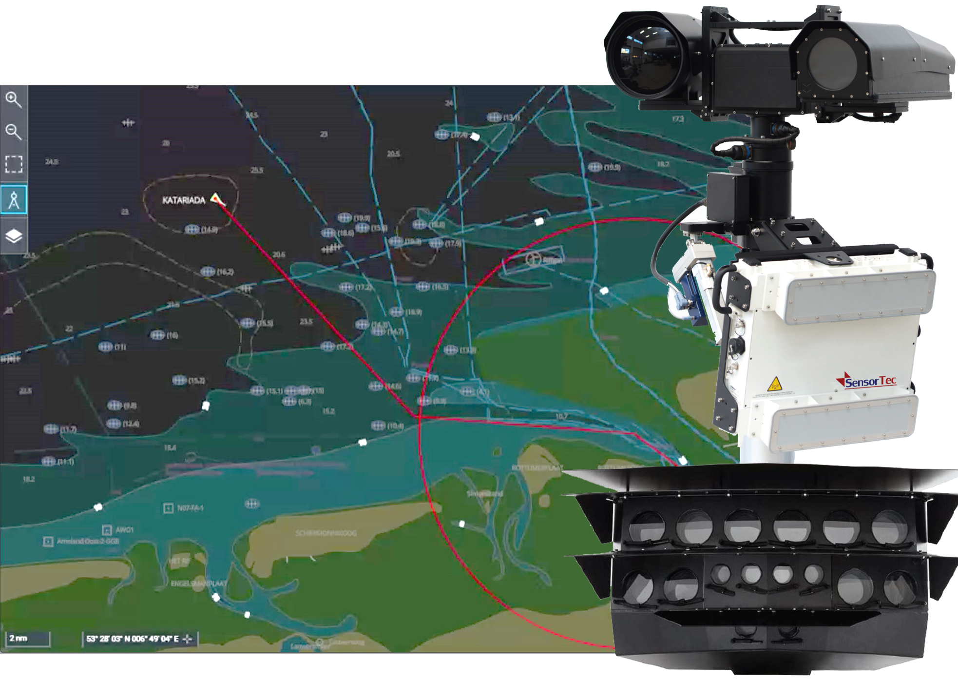
One of the great advantages of our solution is that it can integrate third-party VTMS systems and marine radars, providing automated tracking functions based on AIS and GPS.
In addition to the SensorTec sensors, our system can integrate third-party seismic detectors, fiber-optic sensors, long-range and thermal PTZ cameras, radars and PIDS.
PIONEERING TECHNOLOGIES
SensorTec Panoramic Technology
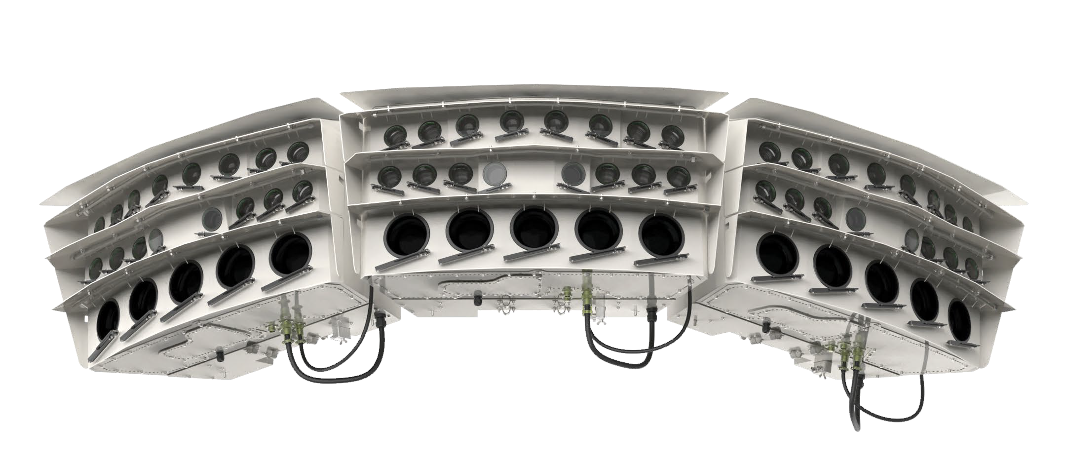 SensorTec panoramic technology makes it possible to geometrically stitch images of SensorTec visible light and thermal sensors. The images are taken in a synchronized fashion which precludes the possibility of duplicated or hidden objects at the stitching borders. White balance and tone correction algorithms smoothen the color gradient between the images.
SensorTec Long-Range Multi-Sensor Technology
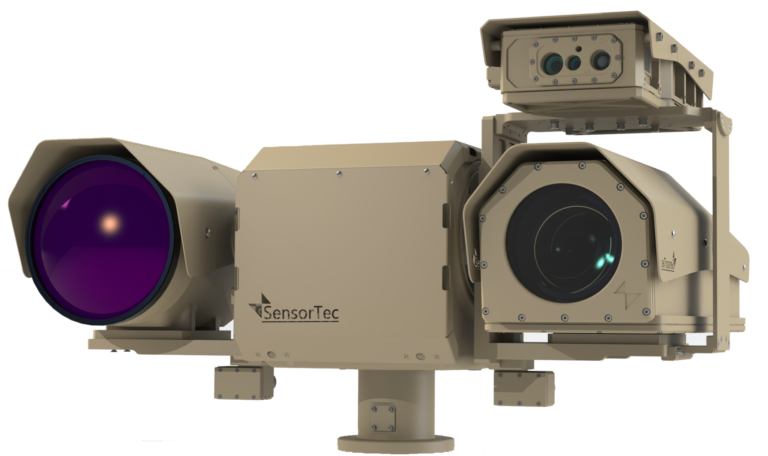
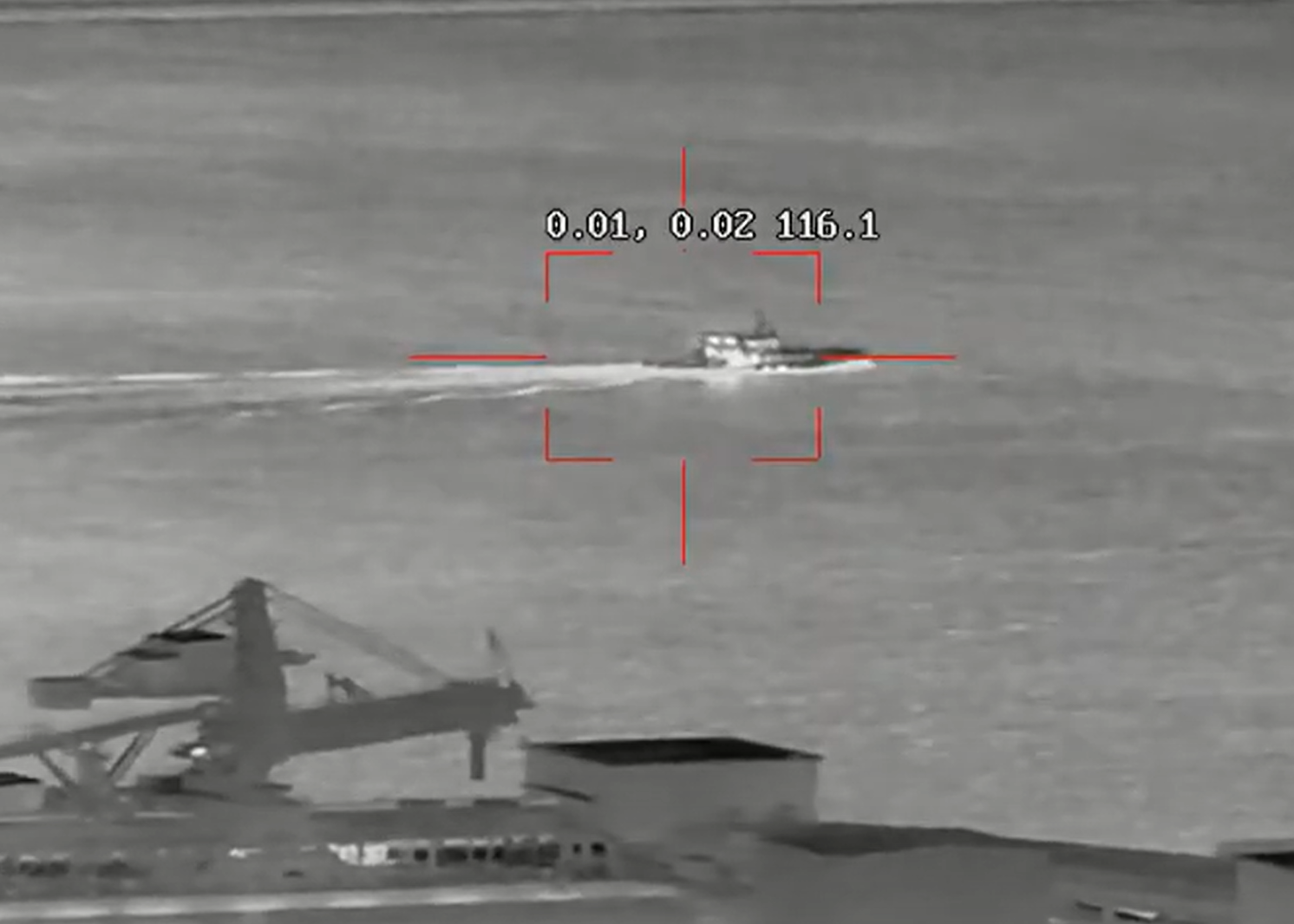
SensorTec provides a leading-edge fully customized multi-sensor systems employing the longest range visible light day/night zoom cameras and the latest focal plane array technology for cooled or uncooled thermal infrared cameras to meet long-range surveillance and target identification requirements.
SensorTec AI-Powered Video Content Analysis

SensorTec AI-based VCA relies on several advanced method. One of them is the Multidimensional Gaussian Background Model that always adapts to the background and differentiates every moving object from the learnt environment.
The VCA also applies object feature extraction, motion behavior analysis and motion path estimation algorithms in order to realize an intelligent, self-learning virtual environment.
Sensor Fusion Technology
SensorTec developed a specific data level sensor fusion technology, which realizes aggregated raw data analysis for the most accurate automatic detection and tracking possible. The AI algorithm works with uncompressed data that are delivered from different types of data sources. This way our systems are able to overcome the limitations of individual sensors and provide more reliable information of the monitored area and the objects within.
On-Site Recording
SensorTec 4th generation data processing units are available with a special, outdoor design. They are weather and vandal-proof constructions with integrated thermal management to operate on-site. This feature significantly reduces installation costs, as there is no need to deploy fiber optic infrastructure over hundreds of kilometers between the cameras and the control centers.
MAIN FEATURES AND FUNCTIONS
Monitoring
- 200-960MP long range dual vision panoramic video stream.
- Long range multi-sensor monitoring.
- Real-time monitoring in full resolution.
- PTZ control on panoramic images.
- Interactive map.
- Automatic zoom tour.
- Archive video.
AI Video Content Analysis
- Object automatic detection.
- Object automatic tracking.
- Object classification (animal, human, heavy and light vehicle, boat, vessel).
- Multiple target tracking through multiple camera images.
- Tracking path.
- Object speed and direction detection.
- Automatic zoom and tracking function.
- Geofencing.
- Virtual fencing.
Integration
- Vessel traffic management system (VTMS).
- Automatic identification system (AIS).
- Long range PTZ cameras.
- Radar systems.
- LASER range finders.
- Positioning systems.
- Seismic sensors.
- Fiber optic sensors.
- 3rd party control software.
Active Response
- Classification.
- Counter.
- Neutralization.
MULTI-LAYERED INTEGRATED SOLUTIONS
VIDEOS
